viernes, 11 de diciembre de 2015

Absolute, Relative Population

The population growth has not been equal between  the large regions of the world. World's population is distributed this way:
80.75% in developing countries
19.25% in developed countries 


First of all, let's understand the difference between developing and developed countries. The developing country is a nation with low living standard,  high population growth, undeveloped industrial based and low resources to live. 

A developed country is a nation that is highly developed economically speaking and also advanced technological infrastructure. Birth rate is lower than others. 
Take a look at the map to identify which countries are in each category. 
Economic Development

Nowadays the world's population grows at a rate of 77 million people per year, highlighting six countries for its notable increase: India, China, Pakistan, Nigeria, Bangladesh and Indonesia. 

To study population we need to know its density, (relative population) which means how many people live per square kilometer . For this purpose,  the number of inhabitants (absolute or total population) is divided between the extensions where they live, in the following way:

Total Population/ Land extension (area)= Population density (inhab/km2)

For example, Mexico and the United States' extensions, our country is smaller, their population density are 50 and 31 respectively, as you can see, it all depends of the territory. Another example is China and India which are the highest in total population but their relative population (density) is not that high due to their high extension of territory.


miércoles, 9 de diciembre de 2015

Answer to Activity #1-Definitions

Definitions 
1.- Population: organisms or species of the same group that live in the same area. 
2.- Demography: the study of human population
3.- Birth Rate: number of births per 1000 people in one year. 
4.- Death Rate: number of deaths per 1000 people per year.
5.- Population Growth Rate: the average annual percent in population change.
6.- Total Population: group of people that lives in a certain area 
7.- Relative Population:relation of the number of people and the area it occupies.
8.- Migration: physical movement from one area to another. 
9.- Emigrants: leaving one country to settle in another 
10.- Immigrants: settling down in another country or area that is not yours. 

miércoles, 25 de noviembre de 2015

Renewable- Non Renewable

How do we know if a resource is renewable or non-renewable???


žNon-renewable resource: a resource that is in limited supply and cannot be replaced once it has been extracted and used.

žFor example, perhaps your shirt and jeans are made from cotton, which comes from a plant. Farmers harvest the cotton crop every year, but the plants grow back and produce more. Cotton, like Incense-cedar trees and all growing plants and trees, are renewable resources! Young saplings grown in nurseries can be replanted to grow a new forest as well as a forest can grow from natural regeneration of the seeds.

žNon-renewable resources are things that are extracted or mined from the Earth, such as petroleum, coal and metals. These resources were created many millions of years ago, when the Earth was forming. Once they are taken out of the ground, they are not replaced. Since there is only so much oil, and the earth cannot replace the oil that is pumped out, we will eventually run out of this non-renewable resource.


Activity #9 and #10 

1. Copy this information into your notes.
2. Choose a partner, you are going to create a collage in your iPad (with images) about Natural Resources
3. Make a short description about it. Explain if it's renewable or non renewable, where we can find it, etc. 


martes, 24 de noviembre de 2015

.. Earth's Layers Foldable ..

This is your project, We will do it during the week

You will need: 5 blue sheets of paper, a copy your teacher will provide, glue, markers or color pencils, pen.  


Make an Earth's Layer's Foldable©! Using the copy your teacher gave you. 
NOTE: Please follow the directions carefully!

1. Color the four layers using this guide:
  Inner  Core  -  red
 Outer Core - red-orange
  Lower  Mantle  -  orange
  Middle  Mantle  -  light  orange
   Upper Mantle- Yellow
  Crust- blue for oceanic crust and brown for continental crust 

2. Fill out the small squares with the information for each of the main layers of the Earth, using your notes.

3. Now you may cut out the layers! Also cut out the four squares and the 12 labels. Remember to cut out The Earth's Layers title. DO NOT LOSE THEM! 

4. Set a piece of 8 by 11 blue paper in front of you. Closely trim the title. Paste The Earth's Layers title in the top left corner of the paper (or bottom right corner after you have folded and stapled the pages together--see Image).

5. Paste the Crust on the top of the first blue paper, to the left of center on the page--see Image.

6. Set a second piece of 8 by 11 blue paper on top of the first, close to the bottom of the crust.

7. Paste the Mantle on the second piece of paper. Part of the blue will show near the brackets. That's okay! You can clip it out later.

8. Carefully lining up the bottom of the top blue paper, and holding tightly, fold up the bottom of paper to about 1/4 inch below the bottom of the Mantle. Then fold up the bottom blue paper up to about 1/4 inch from the bottom of the blank blue paper.
9. Staple the fold with two staples very close to the edge.

10. Paste the Outer Core on the third flap down.

11. Paste the Inner Core on the bottom flap. Paste the Inner Core Information Square to the left of the Inner Core.

12. Paste the three other squares inside the flaps, on the corresponding Layers.

13. Cut out any of the blue flaps that show. 

14. Make sure to include 2 different FACTS! about each layer


14. Write your name. CONGRATULATIONS! YOU ARE DONE AND YOU ARE AMAZING!


This is how your project should look like.


lunes, 23 de noviembre de 2015

Weather and Climate

Have you ever asked yourself why in Juarez is so hot during the summer while in Mexico city is raining all the time? Or why in some areas is full of forests while others are covered with deserts? Let's find out the mysteries of climate.

Sun and Climate

We already learned that Earth is surrounded by the atmosphere, which holds a combination of gases called air, it has many layers which protect us from sun rays. The layer closest to earth is the one that determines weather. When you go out from your house and you say Oh! what a beautiful day, warm and sunny! you are describing weather. It refers to the unpredictable changes in air that take place over a short period of time.

If I ask you how is summer in Juarez or El Paso, you might say that summers here are usually very hot, well, this answer is describing climate. climate is the usual, predictable pattern of weather in an area over a large period of time.

Let's ask ourselves, what causes climate? The original source is the sun. It gives energy and light that all the plants and animals need to live. Sun's rays warm the air, water and land on our planet. Warm gases and liquids are lighter than cool gases and liquids, because they are lighter, warmer gases and liquids rise. then wind and water carry this warmth around the globe, spreading the sun's heat.

Let's also remember that earth's revolution and earth's tilt also affect climate because of the angle at which the sun's rays hit the earth. 

Wind Effect on Climate 


W      When the air moves is called wind. During a year winds follow patterns, they move east and west or  north and south. Analyze the following image. 
Warm winds are marked in red, Cool winds are marked in blue


Remember that warm air rises and cold air falls, thus, the warmer winds near the the Equator rise and move north and south toward the poles of the Earth. The colder winds from the poles sink and move toward the Equator. Since the Earth is rotating, this causes the winds to curve and be in constant motion in many directions. 

Ocean Currents 

Winds can also move water, this is called currents, they carry warm or cool water through the world's oceans. These currents affect the climate of land areas. 

Warm currents tend to move along the Equator or from the Equator to the Poles, cold ones carry only cold water toward the Equator. 
Take a look at the current called Gulf Stream, it goes from Gulf of Mexico along east coast of North America, it crosses Atlantic Ocean toward Europe where is called North Atlantic Current. When it blows over there it brings warn weather to western Europe leaving Canada with a not-so-warmer climate. This is the effect of ocean currents in climate. 


Activity #8

Create a chart like this one. Write at least two details that explain how each force contributes to climate. 


jjj


martes, 17 de noviembre de 2015

The Water Cycle

How is it that we have water on earth? Does it change? 
Water on Earth does not stay in the same place, it moves constantly  due to a process called The Water Cycle, in which water goes from the oceans to the air to the ground and again back to the ocean, that is why it is called cycle.

Here are the steps in order of the Water Cycle:
§First, the sun heats water on earth. TRANSPIRATION
§Some of the water evaporates, turns from liquid to gas, or water vapor.
§Water gas (vapor) rises into the air.  EVAPORATION
§As it rises it cools.
§The cool causes the water to condense. CONDENSATION
§Change to droplets and join together until they create a cloud.
§When they are heavy enough ( all together) PRECIPITATION occurs.
Water falls back to earth as rain, snow, sleet, or hail as INFILTRATION


lunes, 26 de octubre de 2015

What happens beneath the Earth's Crust ??

Have you seen on TV or just news about the destruction caused by earthquakes? These events result from forces at work inside the earth.

Plate movements

Many scientists have developed a theory called plate tectonics to explain how the Earth is formed. This theory tells us that the crust is not an unbroken shell but consist of plates, or huge slabs of rock, that move. These plates are floating on top of liquid rock just below the crust. They move, but often in different directions.

How it looks today
Have you noticed that the eastern part of South America seems to fit into the western side of Africa? Scientists have explained that these two continents were once joined together in a landmass called Pangaea.
What happened is that millions of years ago, continents moved apart because of the tectonic movements. This movement is called continental drift.  These plates are still moving but they move so slowly that we don't feel it.

Pangaea
Plates moves..
Sometimes the plates spread, or pull away from each other. That type of tectonic action separated South America and Africa.

When the plates crash against each other, they can produce mountain ranges, like the Himalaya in South Asia.

When they crash but it is a continental plate and an ocean plate, the continental one goes up the ocean one and this will cause molten rock to build up (magma) then, magma can erupt from volcanoes.

Another movement can be when they slide each other because of the pressure, the result is an earthquake.

Earthquakes can be very damaging to both physical structures and human lives, they can destroy buildings, bridges and even break apart underground water. When an earthquake is undersea, it can cause huge waves called Tsunami, waves can reach as high as 98 ft. (30 m)

Also, when plates slide, this movement creates faults, or cracks. One of the most famous faults in the US is San Andreas Fault located in California.

Watch the following videos from links.

http://youtu.be/CtBXTvtFaCU    (earhquake)
Volcano Eruption
Tsunami- Japan 2011


lunes, 28 de septiembre de 2015

Homework # 3  Block1

1.- Go to your dropbox. Ms. Nitza's class, homework folder.
2.- Get the table from the picture that says homework #3 
3.- Paste it into Good Notes.  
4.- Answer your activity of locating the cities.
5.- After answering, locate the cities in your map, it doesn't matter it's not exact point, but I want you to know where they are.
6.- Here are the links where you can have help locating the points of latitude and longitude: 

http://www.findlatitudeandlongitude.com/
http://www.movable-type.co.uk/scripts/latlong.html
http://itouchmap.com/latlong.htm

These are my suggestions but if you find another page that can help you please use it! =)
ALL ARE IMPORTANT CITIES FROM THE WORLD


domingo, 27 de septiembre de 2015

How do I use Maps and Globes?

Hemispheres 
      To locate places on the earth, geographers use a system of imaginary lines that crisscross the globe. One of these lines, the Equator, circles the middle of the earth like a belt. It divides the earth into "half spheres", or hemispheres. Everything north of the Equator is in Northern Hemisphere, everything south of the Equator is in the Southern Hemisphere. 
        Another imaginary line runs from north to south, called the Prime Meridian  It helps divide the earth into half spheres in the other direction. The Prime Meridian will divide earth also in half, everything east of the Prime meridian for 180 degrees is in the Eastern Hemisphere, everything west of the Prime Meridian for 180 degrees is the Western Hemisphere.


Understanding Latitude and Longitude 

Lines on globes and maps provide information that can help you easily locate places on earth. These lines -called latitude and longitude- cross one another, forming a pattern called a grid system.


       Latitude   Lines of latitude, or parallels, circle the earth parallel to the Equator and measure the distance north or south of the equator in degrees. The equator is at 0 degrees latitude, while the North Pole lies at latitude 90˚ (north) 


Longitude   Lines of longitude, or meridians, circle the earth from Pole to Pole. These lines measure distances east to west of the starting line, which is at 0 degrees longitude called the Prime Meridian. The Prime Meridian runs through the Royal Observatory in Greenwich, England. 


Absolute location    The grid system formed by lines of latitude and longitude makes it possible to find the absolute location of a place. Only one place can be found at the point where a specific line of latitude crosses a specific line of longitude. By using degrees (˚) and minutes (') (points between degrees), people can pinpoint the precise spot where one line of latitude crosses one line of longitude-an absolute location. 

Visit the following address so you can watch a video about all this information.
http://youtu.be/swKBi6hHHMA

Resources: 
Geography The World and Its People, Boehm, Armstrong, Lobrecht, Hunkins, Reinhartz. Mc Graw Hill. 2007. 

http://www.youtube.com/watch?v=swKBi6hHHMA

http://www.google.com/imgres?num=10&um=1&hl=en&biw=1366&bih=600&tbm=isch&tbnid=hrsAs1bSC_PaKM:&imgrefurl=http://www.wbwells.com/2012/surveying/longitude/&docid=_QkgNPeWfEFX6M&imgurl=http://www.wbwells.com/wp-content/uploads/2012/04/global_longitude.jpg&w=502&h=442&ei=OflkUJnvEIHW2AXxlYG4CQ&zoom=1&iact=rc&dur=2&sig=117461693911554293376&sqi=2&page=1&tbnh=110&tbnw=132&start=0&ndsp=24&ved=1t:429,r:9,s:0,i:126&tx=347&ty=393


domingo, 20 de septiembre de 2015

2.1 Geographic Space Representation

How to represent the geographic space... 


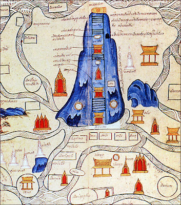
Since the past, human beings have had the necessity of searching or investigating how is the place where we live. The first humans that live in the world made their representations by doing some drawings where they painted natural resources like mountains, rivers, oceans, caves or other common features that surrounded them. To have a better idea of their space, these men used to go to the highest pick and look to their surroundings so they can start doing their sketches; others, used to travel by the shores and in that way they could have the maps of the territory they lived in; they were also guided by the sun or the stars. 
Can you imagine having the maps from that time, do you think we could be able to understand them? 
Source:  http://www.ballantynethebrave.com/blog/topical/cartography/

Source: mappa.mundi.net


"What we all love about ancient maps is that they communicate more than mere spacial, geographic concepts. They are treasure troves of information and insights into past cultures, revealing notions of sovereignty, nationhood, national priorities and loyalties, the level of scientific advancement of the day, astronomical charts, religious beliefs, speculations of deep sea creatures, and the locations of important events. Modern maps are, thanks to scientific advancements, more accurate and precise, but sadly, they have lost a lot of their depth of meaning." (ballantynethenbrave.com blog)  


It was until XIX and XX century when technology advances allowed the improvement of maps because it make them close to reality.   
Today, we can use different things to get to know our geographic space, there are satellite images, aerial pictures, 3d maps, sketches, GPS, even a globe. 
Who make those maps? For what reason we need pictures from satellites? There are a lot of reasons why we need them; imagine your family wants to establish a business, let's say a restaurant, how they are going to search about the area where to put the restaurant? Using images from satellites we can search about location, if it's good or convenient. How do you think they can search people? YES! with maps! According to the interest is what you will use. 

Types of Representation... 

 *Sketch: The easiest way to represent geographic space, it's a simple drawing that works to locate a place and its route. 


*Map: It is the most conventional way to represent a humanized space, it needs to have very specific directions. 


*Globe: A sphere that has the most accurate representation, why? because is the same shape as our planet! 


*Satellite images: Is an image taken from space by a satellite, using this image we can know about process and natural phenomena that affect geographic psace. Nowadays we have Google Earth as well as Google Maps. 

*3d Images: They represent a part of the land, specifically landforms like mountains, hills, etc. With this tool we can get a more real idea about our geographic space. 

*Aerial photo: these photos are taken with special cameras that are placed in airplanes flying at certain height; these pictures are used to create maps. 


miércoles, 9 de septiembre de 2015

1.2 Geographic Space Analysis

Geographic Space Analysis Categories 
The analysis of the Geographic Space will let you understand and comprehend that we belong to a time and space, that we are related with the natural process that happen around us, that the world changes and affects our lives. 

1-Landscape
Natural Landscape 
A landscape is all what you can see with your eyes, it needs to have common features, could be natural, social, or made by human. 

2- Geographical Area 
Rural Area 

Urban Area

Geographical area, where life can be developed, relationship between nature and society. 

3- Region 
Regions

Mayan Region
A region is an area that shares certain features like climate, vegetation, land forms, even culture, like its shown in the picture, the Mayan region; can you recall another region from your country? 

4- Territory
Mexico's Territory
It is an area under a government, could be a whole country, a province, a city, but it includes everything, the soil, subsoil, territorial water, aerial space and of course its natural resources. 

5- Place 
Your school
A place can be a location, a neighborhood, where people create communication with each other, special bonds, either social, economic or cultural so they can be integrated to a group. 

Activity #5
Copy into your notes the activity is called GeographicSpaceCompareChart,you can find it in Activities folder; follow directions and add a title. 
Activity #6
Get into Dropbox and find the word search about this topic. 


martes, 25 de agosto de 2015

1.1 Geographic Space

Geographic Space 
What is the Geographic Space? 
Look around you, where are you sitting down? Where are you standing? Where are you walking? 
Every point of our planet that is accessible for human beings is a GEOGRAPHIC SPACE, where we build our lives and use all the resources that the planet gives us to survive. 
Any place that the human being can inhabit, transform or modify and also get a benefit from it will be part of the study of Geography. 
So, Geographic Space is the product of transformations that humans do for periods of time,
why? just to satisfy our needs like food, clothing, home, work even amusement.
Look at the next picture, how it changes from being a natural space to a geographic space..


This space continuously has to be transformed, as you can see in the picture from natural components, will go to social components, and here is where a new component is formed, the economic component.

Natural components:
Desert, waterfall, volcanoes, animals
Social components: 
People, culture,media, construction

Economic Components: 


Every space is different and develops in different way, why? well because of the natural resources it may posses or the government, the fluency of population, investments, and many other reasons that we'll find out during the class. 


  • Transformation of a space implies removing all natural, to satisfy human needs, here is where you as a student have to be conscious about taking care of the only natural resources we have. You have a very important role taking care of our planet and your own geographic space. 

Look into your Dropbox Folder to see which activities we have to do for this topic. 


lunes, 24 de agosto de 2015

Welcome to Geography Class!

We Love Geography 
Welcome!!! to your first year of Junior High! We are going to have a great time together... =)
Are you ready??

My name is Ms. Nitza Matus and I am going to be your teacher for this year. I created this blog so we can be in constant communication and also will be your space to come and get some information about the class. 

You will find the activities, homework, even quizzes can be uploaded here, in case you lost some info during classes. 

In case you have some questions regarding class, please comment here or send me an e-mail.

Hope you enjoy it! and once again, WELCOME! =)